
Trace a Tuckahoe Street Address
A street-by-street search in Tuckahoe is an address-record exercise, not a way to assume a complete household list. Start by standardizing the address with USPS ZIP Lookup, including the postal city it returns. Tuckahoe is a census-designated place in Henrico County, and an address may carry a Richmond or Henrico postal label. Keep that label beside the returned situs address. Then use the parcel identifiers and legal description to connect assessment, map, deed, and historical address sources without treating one name field as proof of occupancy.
- Search the address in the Henrico property form and save the returned situs label, GPIN, PID, current owner label, and deed book/page reference.
- Open the same parcel in the public GIS viewer. Check its polygon, master address point, street centerline, subdivision, and nearby parcel context.
- Use the deed book/page to move from the parcel card to the grantor and grantee trail. Record each instrument type and recording date.
- Treat voter information as limited civic context. The individual status tool is not a public street-browsing roster, and protected addresses are excluded.
- For an older address, check the directory street section, nearby numbers, and cross streets. Match a directory date to deeds, census geography, or newspapers before drawing a conclusion.
That sequence keeps the Tuckahoe address trail focused on what each record actually establishes. A parcel card can identify a current owner of record. A deed can document a conveyance. A directory can place a past household at a printed address. Those are useful links, but they are different kinds of evidence.
Tuckahoe Street Directory Search Fields
The Henrico Real Estate Property Search is the practical starting point for a Tuckahoe property query. Its primary form is built around parcel and address information, not a name-first lookup. Enter a street number, prefix, street name, and unit as separately available pieces. If a broad street search produces too many results, work in number ranges or define a shorter segment with the map. The inspected form does not state an export option or result cap, so it is better to keep a careful working list than promise a complete street download.
| Henrico field | Format | Street use | Research caution |
|---|---|---|---|
| GPIN | Text | Links a known parcel to assessment and GIS material. | Save it exactly as returned. |
| PID | Text | Supplies a second parcel identifier. | Form guidance does not state a required format. |
| Street # and Prefix | Text | Separates the number and directional part of a situs address. | A prefix can be omitted from an older source. |
| Street Name and Unit | Text | Finds the street and a unit where recorded. | A unit may not appear on a tax parcel. |
| Use Code, Description, Sort By | Controls | Refines or arranges a result set. | Static official text did not expose all available options. |
The assessor search form displays GPIN, PID, street, use-code, description, and sort controls rather than an obvious Owner Name field. That design is a Tuckahoe research quirk: owner information appears on a result card, but the inspected primary form should not be represented as a general owner-name search.
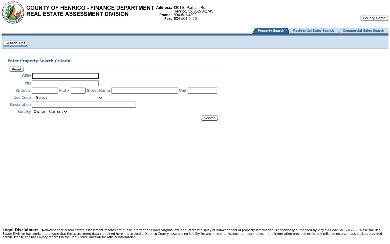
The form image shows why a street search should retain the returned parcel identifiers before moving to another Henrico record system.
Read Tuckahoe Parcel Roles Carefully
A Henrico parcel card supplies more than an address. Typical results display GPIN, PID, subdivision, section, block, lot, acreage, current owner, Owner (Jan. 1), mailing address and ZIP, last transfer date and price, deed book/page, and map references. Its building and assessment areas can add physical characteristics, photos, sketches, plats, and old-card links where they exist. Availability and historic depth vary by parcel, so a blank link is not proof that no earlier record exists.
Owner labels deserve special care in Tuckahoe by-street research. The situs address is the parcel location used by map, zoning, permit, and assessment work. The mailing address is where tax correspondence goes and may belong to a fiduciary, a post-office box, or another address. Owner (Jan. 1) is an assessment-year snapshot; Owner (Current) is a separate current display. Neither label alone establishes who is physically present at the situs. The county also warns that online real-estate data can contain errors and should be verified against the official record when the detail matters.
- Parcel
- A defined piece of land used in assessment and mapping records, normally tied to a GPIN or PID in Henrico.
- Situs address
- The physical location assigned to the parcel. It is different from an assessment mailing address.
- Plat
- A recorded map that can show a subdivision, lot, boundary, or other land layout detail.
- Criss-cross directory
- An address-first directory section used to locate a printed household entry by street and number.
Map a Tuckahoe Street Directory Segment
The Henrico County Map Viewer supplies the map side of a by-address search. Turn on Tax Parcels, Master Address Points, Street Centerlines, subdivisions or condominiums, and Historical Parcels only as needed for the segment at hand. GPIN points, voting precincts, zoning, aerial imagery, and planimetric layers can add context. Identify a polygon rather than relying on a label that happens to be visible. If a polygon has no clear address label, take its feature or parcel identity back to the assessment card.
The county's GIS layer directory also exposes tax-parcel and related services when the visual viewer is slow. It does not turn a map into a legal survey. Henrico labels GIS information as reference-only, not a legal boundary or flood determination. Layer dates vary, and the available research did not establish a universal historical start year. Preserve the date and layer name with any map observation, especially where a Tuckahoe street crosses a subdivision or precinct line.
Follow a Tuckahoe Street Deed Trail
Use the deed book/page on the parcel card as the bridge to the Henrico Circuit Court Clerk land-record route. Record the grantor, grantee, instrument type, recording date, book/page or instrument number, and legal description. Then search the predecessor in both grantor and grantee roles. A deed of trust, release, lien, or plat may be recorded beside a conveyance, but it does not by itself establish a change in ownership or residence.
The statewide Virginia Secure Remote Access system distinguishes an index route from possible subscription image access. Official sources inspected for this project did not state Henrico's online start year or guarantee that every image is online. When the web route stops, call the Record Room at 804-501-4249, use the public courthouse computer or a subscription as the clerk describes, and request a paper copy if needed. The Record Room is at 4301 E. Parham Road, Room 230, open Monday through Friday from 8:00 to 4:00; staff can explain access but do not perform the research. Paper copies are listed at 50 cents per page.
The SRA landing page illustrates the difference between an online index path and an image-access path. Keep the counter and copy route in the record plan rather than assuming a missing web result means the instrument is unavailable.
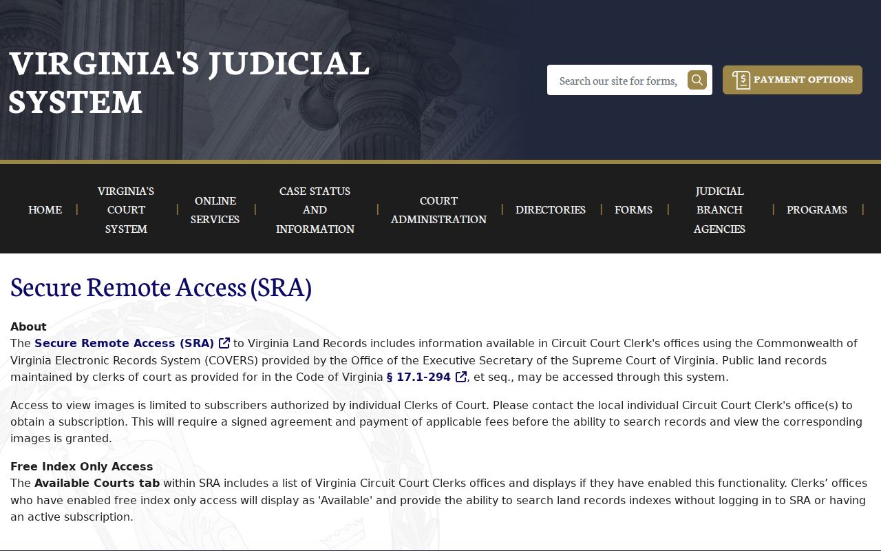
For a Tuckahoe address, the book/page and legal description are the details that reconnect an SRA or Record Room entry to the exact parcel.
Tuckahoe Street Records by Address
An address-by-address Tuckahoe record trail becomes stronger when each row carries a source, date, and role. The same street number can point to a current parcel, a past directory entry, a permit project, or a census household. Those sources have different coverage and should not be merged into a single claim about everyone connected with the address.
| Address record | Period or reach | What it can show | Best access route |
|---|---|---|---|
| Assessor parcel card | Current card; historical cutoff not stated | Situs, owner labels, mailing address, transfer reference, map bridges | Free Henrico property search |
| GIS parcels and address points | Current and historical layers; dates vary | Parcel geometry, nearby lots, subdivision, centerline context | County viewer or REST layers |
| Circuit Clerk land records | Surviving books from 1781 onward, subject to losses | Recorded ownership chain, legal descriptions, plats | SRA, public counter, or copy request |
| Directory street section | Address sections from 1879-80; local coverage varies | Printed name or household at a numbered address | Richmond Room, VMHC, or LVA access |
| Permit and planning record | Online submissions after August 30, 2021; earlier reach unstated | Project, status, and date clues | Build Henrico, planning counter, or focused request |
Public voter-list information has its own statutory limits under Va. Code §24.2-444. It can support a lawful civic comparison where access is permitted, but it is not a complete street roster. Protected residences and private identifiers are excluded.
Tuckahoe Street Directory Map Bridges
Old Map Number, Pre-1992 Map Number, and Map Page Number on a current card are unusually useful Tuckahoe address bridges. Copy them exactly, then ask the Record Room for the related map or deed-book context. Pair those identifiers with the subdivision, section, block, and lot from the same card. A legal description often survives an address change better than a street number does.
No official source located a universal Tuckahoe street-renumbering date or a local renumbering schedule. That absence matters. Do not assign an old number to a current parcel from a guess. Instead, use current USPS standardization, GPIN/PID, old-map fields, the deed legal description, subdivision plat, and then an address-section or cross-street check. Historical aerial or Sanborn material is useful only where the source actually covers the area.
Tuckahoe Street Directory in Print
For a past address, the most useful historical directory feature is the street-address section rather than a name-only listing. The Virginia Museum of History & Culture reports that Richmond directories have an address section organized alphabetically by street and numerically by address from 1879-80. Its guide identifies Richmond directories nearly every year from 1870, while warning that Richmond and suburban coverage is not the same as the modern Tuckahoe CDP boundary.
Search the printed number, nearby numbers, and cross streets. A dedicated continuous Tuckahoe reverse-directory series was not identified in the inspected local sources, so do not assume one exists. The Richmond Room confirms phone books and local directories, and its shelves can supply a regional lead. For collection locations and access choices, use the Tuckahoe City Directory record trail. Confirm any name and address against the parcel, deeds, census geography, newspaper, or probate record that matches the period.
Tuckahoe Street Permits and Aerial Clues
Permits and map imagery can help date change along a street, but they answer a different question from an address search. Henrico's Build Henrico portal handles submissions after August 30, 2021. For an earlier file, check the live portal, contact the Planning or Permit Center, or make a focused records request. A permit can identify a project, status, and date, and may expose information in the public interface. It does not establish every person who lived at the address.
Use aerial or planimetric layers beside the permit date and assessment-card features. Label a remodel, addition, demolition, or structure appearance as a physical-property clue. The relationship between a project and an occupant should never be assumed.
Note: A street address, parcel key, and source date make a stronger local record than an unlabeled name copied from a map or directory.
Tuckahoe Street Directory Voter Context
Virginia's Citizen Portal is designed for an individual registration-status check using name, date of birth, the last four digits of Social Security number, and locality. It does not offer a public control to browse every voter on a Tuckahoe street. Where a lawful public voter list is available, address and precinct fields can provide limited civic-geography corroboration. That is not proof of a full household or of a current resident at a parcel.
Virginia law defines public voter fields while excluding Social Security numbers, full dates of birth, protected residence data, and agency identities. Registration can be protected or stale. Keep voter material separate from the assessor's ownership labels and from historical directory observations.
Limits of a Tuckahoe Street Directory
Address records do not reveal every person who receives mail, uses utilities, or has a connection to a property. Private household details, protected voter residences, sealed court parties, DMV address data, and many other personal records are outside an address search. A current owner may live elsewhere, and a historic directory entry may be a dated lead rather than a title record. The correct practice is to label each result by source, role, and date.
Lawful use. Use Tuckahoe address records for personal, lawful research, family history, estate work, or property curiosity. Do not use any result to stalk, harass, or harm another person.